Explore the A’ershan National Forest Park, a natural reserve that contains volcanic landscapes, mountaintop lakes, deep forests, grasslands, rivers, and mineral-rich springs.
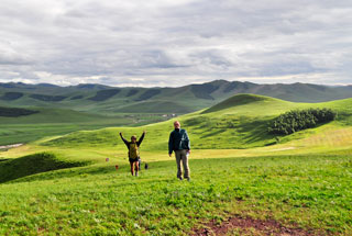
Meet up in Ulan Hot, drive to A’ershan, hill walking from Rose Peak to Black Stone Peak
Day Two main activities
Full day in A’ershan Forest National Park, visiting crater lakes and lava flow area
Day Three main activities
Hike in hills and forest near A’ershan town, hot springs, drive to Ulan Hot
Day Four main activities
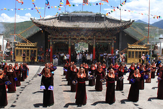
Walkabout in Ulan Hot
A’ershan Forest National Park
A’ershan Forest National Park is a 100,000+ hectare nature reserve in northeastern Inner Mongolia famous for its volcanic landscapes, mountaintop lakes, deep forests, grasslands, rivers, and mineral-rich springs. The park infrastructure is well developed, with boardwalks and paths leading to the key scenic areas.
The nearest town is also named A’ershan: a 3–4 hour drive through small grasslands towns and vast fields and plains from the airport at Ulan Hot. The population of A’ershan is somewhat seasonal, with more people about during the warmer summer months—not surprising, when January sees an average high of -17.8°C!
A'ershan is the pinyin for the phonetic representation of the Mongolian name for the area after it's been converted into sounds that occur in the Chinese language. The Mongolian name means 'spring', or 'spa', and sounds a bit like 'Ar-shan'.
• Distance: 4.5km• Approx. 2 hours of hiking• Start/finish height: 860m• Peak: 1,086m• Total ascent/descent: 240m
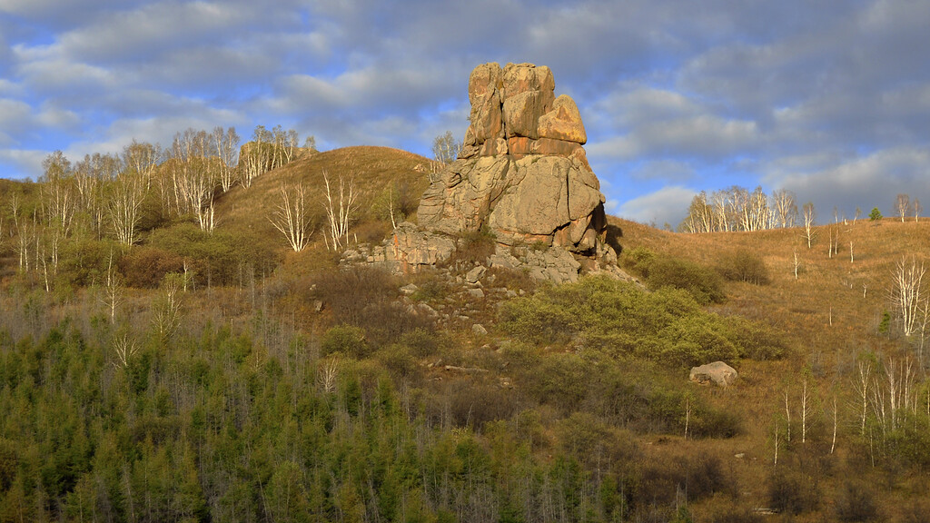
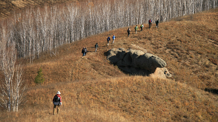
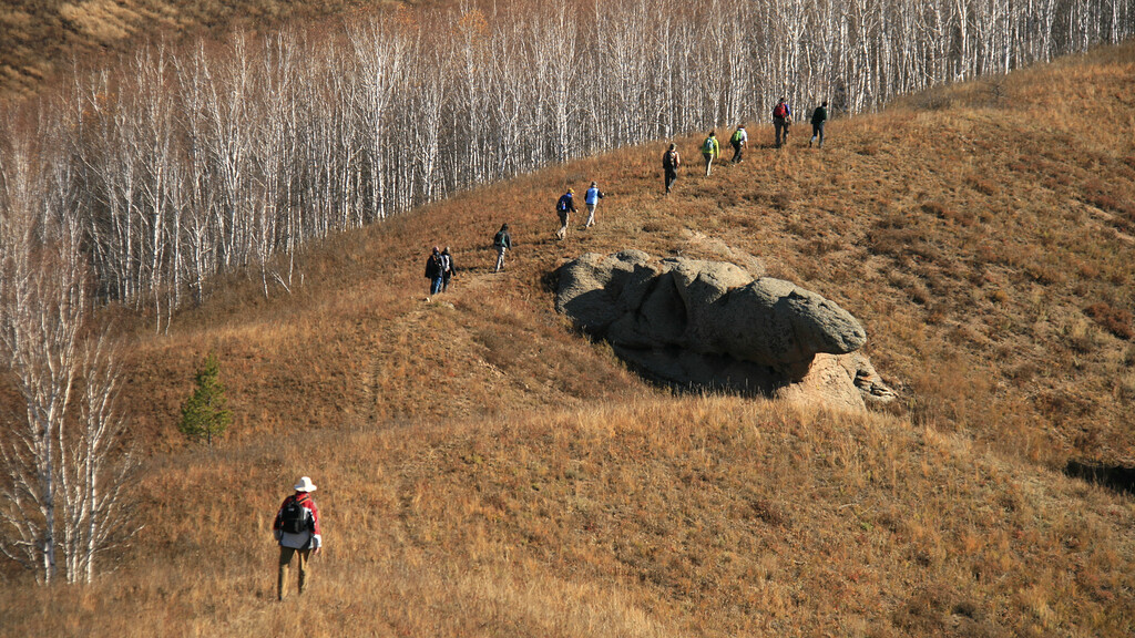
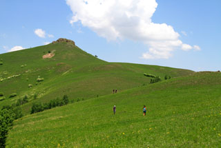
Rose Peak is a large outcrop of rose-coloured rock that protrudes from one of the lines of hills that surround A’ershan City. For fans of geology, the type of rock is granosyenite. Rose Peak is the start point of a scenic hike that will take us through the hills and past other strangely shaped rock formations formed by strong erosion and frost weathering.
The hike is not a long one, but starts with a fairly steep climb up past the big rocks of Rose Peak. The climb gets us up on to the ridgeline, and thereafter the ups and downs are more gradual. We follow the ridgeline past forested hills up to a peak, and then walk down and out a valley to finish, passing a few farm houses on the way.
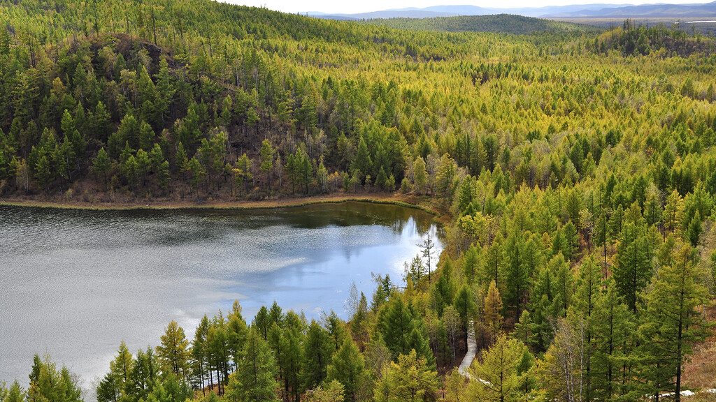
Pines behind Azalea Lake, inside the A’ershan National Forest Park. (Click for larger image)
A'ershan Forest National Park ‘Heavenly’ Crater Lakes
A'ershan Forest National Park is huge, and some of the key places to visit are somewhat spread out. We'll drive between each, getting out for walks of 1–2km. We'll break up the sightseeing with a big lunch at a restaurant in the park.
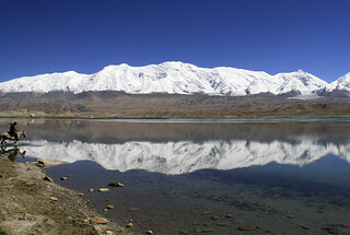
At 1,332m above sea level, A’ershan Tian Chi is the third highest of China’s many ‘Heavenly Lakes’. The lake itself is a volcanic crater of the Maar type, formed an estimated 200,000–300,000 years ago. Maar-type craters are formed after explosions caused by contact between lava and groundwater, and commonly become lakes. A’ershan Tian Chi is surrounded by thick forest and is a deep-blue colour. It is not a large lake (0.3 sq/km) but is said to have a depth of more than 300m. The water level remains constant throughout the year, rain or shine.
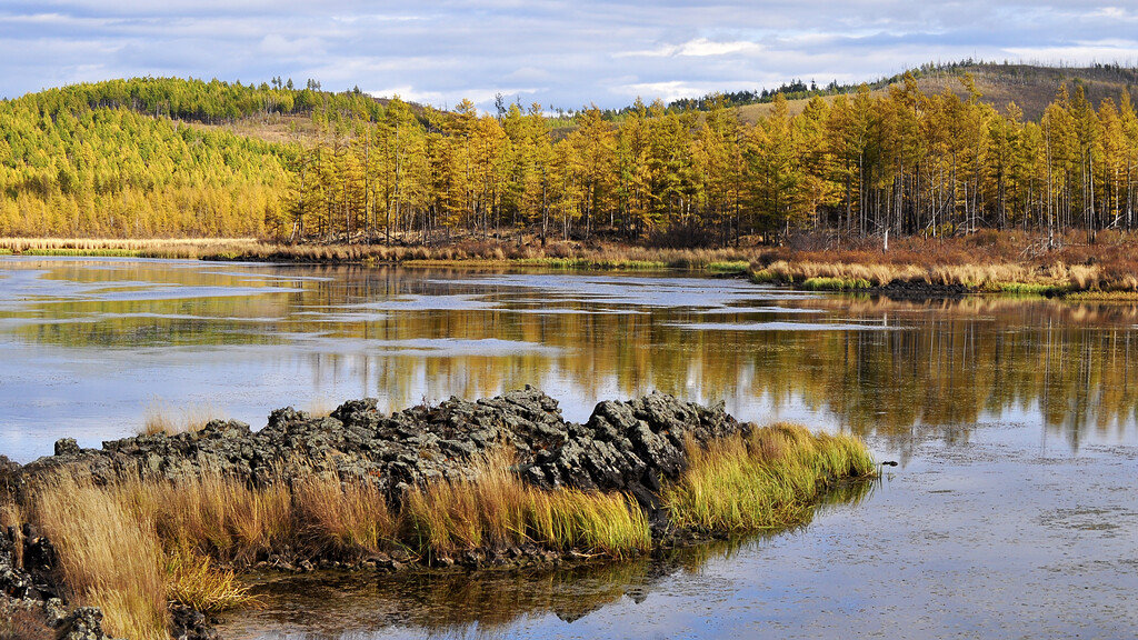
We’ll visit another two of the crater lakes on our way through the park, and if there's time we'll take a walk up a trail by one of the rivers as well.
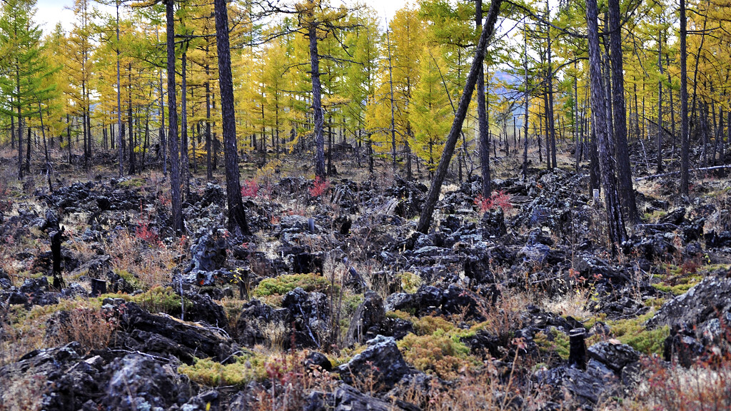
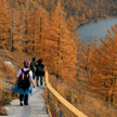
Aside from the lakes, forests, and hills, the A’ershan National Forest Park has an interesting area where lava flows solidified. A boardwalk has been constructed to allow visitors to explore without damaging the delicate environment that has since grown up on top of the lava. The boardwalk leads through a forest and by smaller lakes, with signs giving extra information about special things to look out for.
We'll take a stroll up into the hills in front of our hotel, walking through A'ershan Town on the way to the start of the trail. Another fairly steep climb gets us up on to the ridgeline; after that the trail is mainly flat, passing through pine forests and following a firebreak on the way to a small hill trail that takes us down a steep slope and over train tracks. The hike finishes by a clear spring, which is supposedly healthy and good for drinking. Our bus will meet us here and drive us back to the hot springs in town, where we'll have a soak before a big lunch.
Hike statistics: Hundred Flowers Valley Loop
• Distance: 4.5km• Approx. 2 hours of hiking• Start height: 1,003m• Peak: 1,165m• Finish height: 990m• Total ascent: 208m• Total descent: 241m
A’ershan Hot Springs
Mineral-rich springs well up from as far as 3,000m below, part of a 50-year cycle between the surface and the underground – some of the springs are hot, some warm, and some cold. Aside from being a pleasant spot to soak, the minerals in the water are said to have health benefits. We include a soak at the springs as part of the trip.
Getting to and from Ulan Hot
You’ll meet your guides at the Ulan Hot Airport between 9-10am on the first day of the trip.
The itinerary will finish in Ulan Hot on the last day of the trip, and we plan to drop you off at the Ulan Hot Airport around midday.
Please do not purchase your flights until we are able to confirm the departure of the trip.
Related content
Photos and trip reports: A’ershan Forest National Park, Inner Mongolia