Shunyi Hikers: Chenjiapu Great Wall
An old trail with a new name—a moderately difficult hike that follows a line of wild wall up to a tall tower with 360° views of mountains, valleys, small villages, and a long line of wall heading high into the hills. Some sections extremely tricky underfoot.
Booking info
Sunday, July 2
¥400 / ¥360 for members
Pay on the day of the hike. More about payments
Old hike, new name! Now that it’s easier to go to and from Hebei Province, we’re going to start hiking here again.
We’ve had a variety of hikes here with names like the Middle Route of Switchback Great Wall and Stone Valley Great Wall. It’s also known as the Chen Castle Great Wall, which is another way you can translate the name of the closest village.
Starting the hike on the Hebei side of the border means we’re up on the wall a little bit faster, and we’ll be hiking on the wall for a larger percentage of the whole hike.
Starting the hike on the Hebei side of the border also means we’ll need to pack our passports, just in case we get checked at the border crossing on the way back into Beijing.
The hike
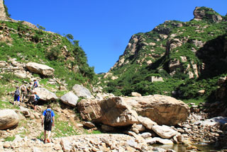
We start the hike not far past Chenjiapu Village, taking a short walk up a concrete road before turning off on to a dirt track that leads up a valley towards the Great Wall.
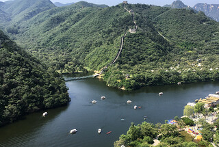
The valley is narrow to begin with, and slowly opens up to give views of Great Wall and towers on a high ridgeline.
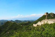
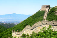
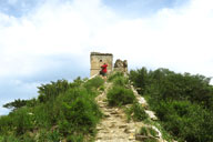
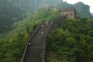
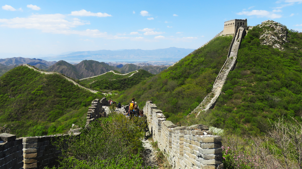
At the top of the valley we’ll find the Great Wall, with two mostly-intact towers sited to guard a pass at a dip in the mountains.
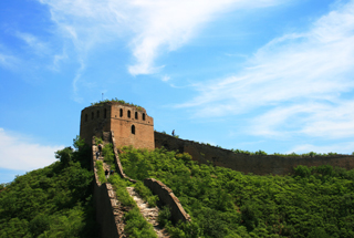
We’ll be headed north from the dip, following a rough line of ‘wild’ Great Wall through the two towers and up to the local “General’s Tower”.
At an elevation of 1,040m, the General’s Tower has superb views of all the Great Wall in the area.
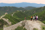
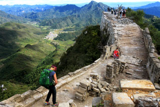
To the east we’ll be able to spot the eastern side of the Stone Valley Great Wall and possibly parts of the Badaling Ancient Great Wall; to the south we’ll see the higher parts of this line Great Wall, and, if it’s a clear day, the High Tower on a faraway peak.
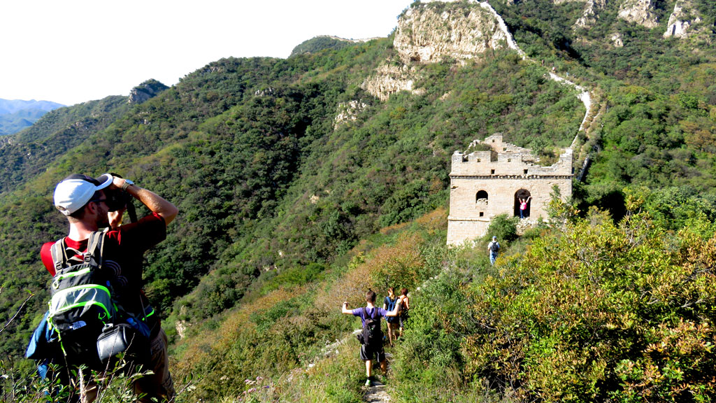
With line-of-sight to all that Great Wall, and a not-too-long hike down to the old fort at Stone Valley Village, this tower was probably the command post for the wall in the area—and that’s why it’s named “General’s Tower”.
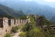
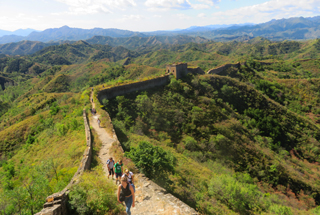
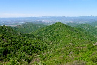
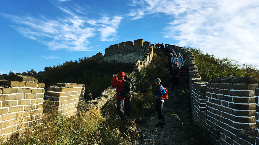
We’ll continue down the wall, taking a few detours around broken sections, and hike along the flatter section of wall above Chenjiapu Village.
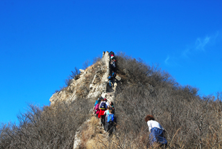
The hike takes us by a few more towers on the way, and there’s at least one tricky section where we might find it easier to hike beside the Great Wall instead of on top of it.
Before the wall gets way too steep to walk on we’ll turn off on to a hill trail, and follow it down to the village road to end the hike.
About the Great Wall here
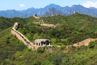
Most of the wall we’ll see on the hike today can be dated to the later part of the Ming Dynasty (1368-1644), in particular the large brick towers and crenellated side walls.
The Ming wall partially covers an older stone and rock wall that’s said to be from the Northern Qi Dynasty (550-577). The Ming Wall forks from the older wall just after the General’s Tower, and sharp eyes can spot the line of rocks and stones that mark the route of the first wall built in this area.
About the village
The village is commonly known as Chenjiapu. But the last character in the name (堡) is one of those that can have a double meaning and pronunciation.
The first entry in the dictionary has it pronounced as bǎo, meaning “an earthwork / castle / position of defense / stronghold / used in place names, often as phonetic bǎo for ‘burg’ or ‘bad’”. So that’s where the name ‘Chen Castle’ comes from.
But it’s also sometimes pronounced as pù, which is a variant of 铺, used in place names or meaning “plank bed / place to sleep / shop / store / (old) relay station”.
We’re not sure if there was actually a castle here, given that the village is outside the main line of the Great Wall. The main ‘old’ thing in the village nowadays is the sometimes-open-usually-closed Dragon King Temple.